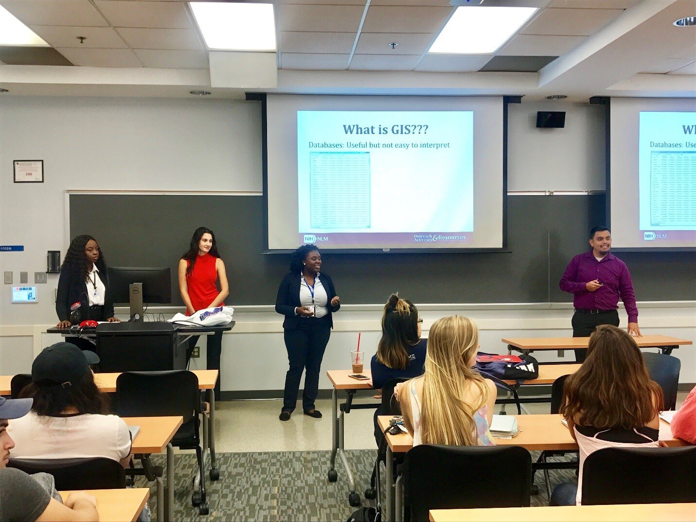
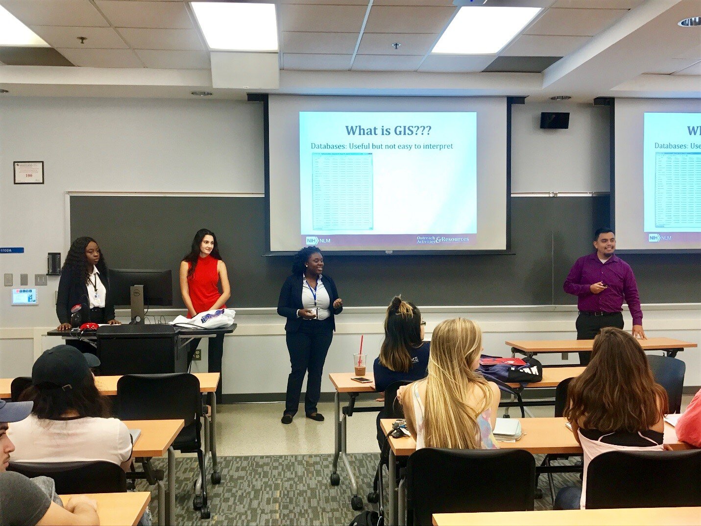
On September 28, 2017, Community Health Maps (CHM) was presented to the Community Health class at the University of Maryland School of Public Health in College Park. The session was provided by Julian Argoti, research assistant at the National Library of Medicine (NLM), and three University of Maryland Public Health interns completing their capstone project at the NLM. The primary goal was to expose the students to the resource and to help them explore how it might be used in their research. The presentation took place within a 95-minute class period with 53 students. The presenters introduced the CHM blog and briefly touched on using Geographic Information Systems (GIS)/spatial analysis to address a public health concerns, as English physician John Snow did in 1854 by mapping the source of a cholera outbreak in Soho, London, and as a former NLM intern did by mapping local curb ramps to help those with mobility issues cross streets safely.
 The students then completed a hands-on data collection exercise. They were introduced to Fulcrum, a low cost tool that allows users to build custom data collection forms for use on iOS or Android devices. Next, they left the classroom to collect data in real time, from the locations of trashcans and water fountains inside buildings to the positions of benches and signs outside them.The session ended with the students exploring a series of exercises designed to help them through the entire CHM workflow, from field data collection to online data presentation. A post-class survey indicated that most participants felt they could use CHM in upcoming assignments.
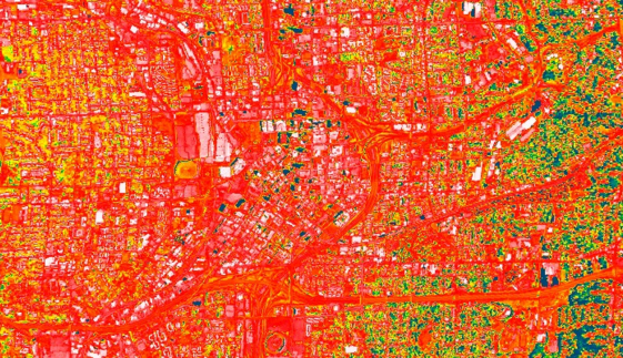
Announcement: Extreme Heat & Health Webinar
There will be a webinar next week entitled: Extreme Heat and Health: Creating Environmental Intelligence Through Science, Predictions, and Engagement. The specific date and time are: April 28th, 2016 from 4 - 5:30pm EDT. This will likely be an interesting webinar for many Community Health Mappers! Click this link to learn more.
Tableau Public for Data Visualizations
Tableau Public is free software that can help users publish interactive data visualizations to the internet. This software is another great option for data visualization along with GIS Cloud or CartoDB. It has powerful charting and graphing tools, and also allows you to map data and display that data against several online datasets and basemaps.No plug-ins or programming skills are required, just a browser with JavaScript enabled. Tableau Public uses a simple drag and drop process that anyone can learn. You can work with either the free Tableau Desktop app, or Tableau Online the free cloud based server. Either way you can save your work to the Tableau Public Web servers, which are accessible by everyone on the Internet. One important note about this is that any data you publish is accessible to everyone on the internet.People see and understand data, reports and dashboards faster with visual analytics technology, which can help uncover key trends, relationships, patterns, and outliers that might otherwise be a challenge to find. Tableau Public can be used to pare down information to its simplest form by stripping away the less important data.The software can connect to Microsoft Excel, Microsoft Access, and multiple text file formats. It has a limit of 1,000,000 rows of data allowed in any single file. Your organization may use up to 50 megabytes of space.Tableau Public projects can be shared by emailing a link or by embedding the work in a blog, wiki, or website. Clicking on an emailed link will open a browser page with the view loaded. If embedded onto a page, anyone who visits the page will see the live interactive view. The following shows the use of Tableau Public in two health related studies.Public Health Case StudiesTo visualize the specific social problem of teen pregnancy over time, Tableau Public was used by the Wisconsin Council on Children and Families to show the decline in births to teen mothers in Wisconsin over recent years. The data depicts racial disparities in teen births in Wisconsin as well as differences in birth rates between older and younger teens. The online link to the data visualizations created with Tableau Public for this study can be found here: http://tblsft.com/public/gallery/teen-pregnancy-declinesThe figure below is a screenshot of one of the data visualizations from this study. Data visualizations are interactive. Here the white popup window is showing data from a specific place on the line graph. Such visualizations may help communities address and manage such issues as health problems associated with prematurity and poor academic performance of children of teen parents.Data can also be mapped by geographic coordinates, city, state, county, and zip code. The visualization below deals with Medicare Costs and combines a map with a chart showing trends in the data.
 Other data visualization examples created with Tableau Public can be found in the Gallery:http://www.tableausoftware.com/public/galleryOther Tableau Public Resources can be found here:https://public.tableau.com/s/resources
How Accurate is the GPS on my Smart Phone? (Part 2)
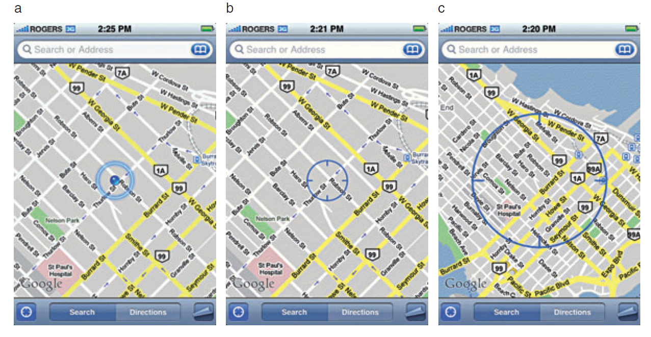
In Part 1, I introduced the three parts of the hybrid locational system used by tablets and smart phones. Now I'll discuss each individually.Assisted-GPS (A-GPS)A-GPS is by far the most accurate of the three systems on your phone. A-GPS operates a little differently than the typical handheld GPS receiver. The assistance is provided by the cellular network. When connected to a cellular network the smart phone will download data about the GPS satellite constellation. This allows the phone to lock in on a position much more quickly than it could otherwise. The GPS functionality of a smart phone can still be used if the cellular network is unavailable. However, when disconnected from a network your phone will take several minutes to hone in on your location, versus just seconds when the network is available.The A-GPS receivers on iPhones have steadily improved from the iPhone 3 to the iPhone 5. In addition to the U.S. DOD GPS system, the Russians have a satellite navigation system called GLONASS. The newest smart phones (e.g., iPhone 4S and iPhone 5) now have GPS chips that use both satellite systems giving increased accuracy! Europe, India and China are also developing satellite navigation systems and in the not too distant future GPS receivers may be able to use several systems simultaneously and become even more accurate.WiFi and Network PositioningFor any GPS to work the antennae needs a clear view of the sky. Users of smart phones will frequently be in "urban canyons" or indoors. This is where WiFi and cellular network positioning become necessary. Both of these methods are used by smart phones as indoor positioning systems. The phone will use a hybrid approach, using all three methods to locate you. These other two technologies aren't nearly as accurate as A-GPS, but can still locate you sufficiently to find the closest vanilla latte!Generally WiFi positioning is more accurate than cellular network positioning. It uses wireless access points and measures the intensity of the received signal from one or more networks to find the position. Interestingly it doesn't require your device to be WiFi enabled to work.Cellular network positioning triangulates your position based off of nearby cell phone towers. Phone companies have precise locations for their cell towers, which when combined with signal strength can be used to approximate your location. Both of these techniques are dependent on overlapping signals from either access points and cellular towers. Therefore they're more accurate in urban settings.So What's It All Mean?From numerous tests the typical GPS receiver will achieve an accuracy of 1-5 meters. Unfortunately assisted-GPS accuracies have not been studied nearly as thoroughly as typical GPS receivers. The best studies to date are those by Dr. Paul Zandbergen at the University of New Mexico. In 2009 he published findings showing that an iPhone 3 had an average accuracy of 8 meters. In that study the error never exceeded 30 meters. Below are the results of his 2009 study including all three locational systems.
- 3G iPhone w/ A-GPS ~ 8 meters
- 3G iPhone w/ wifi ~ 74 meters
- 3G iPhone w/ Cellular positioning ~ 600 meters
Numerous anecdotal studies indicate that the iPhone 4S/5 has become more accurate. In 2011 Dr. Zandbergen tested several Android smart phones. Here he found the accuracies to be slightly better than the 2009 study. They ranged from 5-8 meters. It is likely that the iPhone 4S/5 is within this range as well. It can also be assumed that iPads and other Android tablets will be comparable.Other Options for Increasing AccuracyThere are several third party external GPS receivers that connect to the smart phone via Bluetooth. For example, the Dual 150S can be used to increase accuracy in more remote locations. It can be worn like a wrist watch, placed on a car dash or strapped to a backpack. It will provide 2.5 meter accuracy and only costs $100. SummaryIf getting within 5-8 meters meets your data requirements smart phones and tablets are a great way to go. If you need greater accuracy you can combine an external Bluetooth GPS receiver with your device and get that accuracy down to the 2-3 meter range. If you require more accuracy than that you will need to invest in a mapping grade GPS receiver.
How Accurate is the GPS on my Smartphone? (Part 1)
Historically field data collection was a daunting task reserved for geographic information specialists (GIS) professionals, and the technical savvy crowd. This was largely due to the learning curve involved in operating mapping grade Global Positioning System (GPS) receivers. However, smart phones and tablets have changed that. They offer an amazing array of functionality in a portable, intuitive and ever more familiar interface. Think about all the technology packaged into one of these little devices:
- GPS
- Camera
- Network connection (3G, 4G, WiFi…)
- Internet
- Apps
They're actually better than the Tricorders we used to see on StarTrek! They have a slimmer profile, probably weigh a lot less, have touch screens, bigger displays and can be used with thousands of available apps. One big question when considering smart phones or tablets for field data collection is, "How accurate are they?" A related question that must be answered is, "What kind of accuracy will meet the needs of my project?" You need to answer both of these questions to determine whether or not this technology will work for you. Usually survey grade GPS accuracies (sub meter or sub centimeter) aren't necessary for public health mapping. Getting within 10 meters is more than adequate to map facility locations, patient addresses, potential sources of disease or wellness. How Does GPS Work?The Global Positioning System (GPS) is a U.S. Department of Defense (DOD) system. It utilizes a constellation of 24 satellites orbiting the earth at an altitude of 12,000 miles. GPS devices compute your position by determining the distance between the GPS receiver and a minimum of 4 GPS satellites. The satellites transmit radio signals to the GPS receivers, allowing the calculations to occur. Initially GPS was established as a military guidance system, and I doubt anyone foresaw the popular use it has today.The iPhone has been equipped with an onboard GPS since the iPhone 3, and Android phones became GPS enabled at about the same time. Typically people use GPS to find restaurants and street directions. However, there's no reason these same devices can't be used for public health data collection!More About Smart Phone Locational Services Smart phones in fact use more than GPS to locate you. They employ a hybrid locational system combining three separate technologies:
- Assisted GPS (A-GPS)
- WiFi positioning
- Cellular network positioning.
These three technologies are used in combination as they are available. A-GPS is the most accurate of the three, and cellular positioning the least accurate. The figure below shows an example of the accuracy of each of these locational services. GPS AccuracyThere are a number of factors that affect accuracy no matter what GPS receiver is being used. The GPS radio signals encounter differing conditions while travelling through the atmosphere, causing signal delays, and therefore affecting accuracy. The geometry of the satellites being used will also vary. The GPS will have a wider array of satellites to choose from if you're out in the middle of a big field, versus being on 6th Avenue in Manhattan. You will get better positions if the satellites you're locked onto aren't clustered in one part of the sky. Therefore the more sky view you have, the more accurate your GPS will be. In addition to blocking your view of the sky, urban canyons can also cause multipath effects, where the GPS signal bounces off of buildings or other objects reducing accuracy.In part 2, I'll discuss each of the three pieces of the hybrid locational system individually, and discuss exactly what kind of accuracy you can expect to achieve.

